The violence in Gaza is too recent and sparsely reported to permit substantive comment. Having traveled to that “border” last July, however, and spent some time exploring the region around “it,” I would offer the following bit of advice to anyone who wants to follow the news about “it.” First get clear on what “it” is. Then figure out whether the reporting you’re following is as clear as it ought to be on what “the border” is, where “it” is, who is allowed to do what “there,” and how “it” works in practice.
This is the relevant point, as described by B’Tselem:
Israel treats an area inside the Gaza Strip, near the border fence, as its own territory, using it to create a “buffer zone” inside the already narrow Strip. After the second intifada broke out, the military declared a vast area near the Gaza-Israel border, much of it farmland, off-limits to Palestinians. It never officially announced this policy or clarified to the residents which areas exactly were off limits to them, which increases the danger they face.
I highly recommend reading the whole B’Tselem page on Gaza (the source of that excerpt), and indeed, reading as much of their material as possible.
In practice, Israeli policy makes it impossible to determine where “the border” is, and mainstream American reporting tends to stay discreetly mute about the indeterminacy of its location. This classic New York Times exercise in obfuscation makes reference to “the border,” “along the border,” and “the border zone” without ever clarifying that the border involves a buffer that extends into Gaza, and is controlled by the Israeli military. B’Tselem calls this area a “buffer zone” and a “no-go zone.” It’s more colloquially known as a “kill zone” for reasons that should be self-explanatory.
Just to be clear: a Gazan Palestinian can be killed by the Israelis for venturing into the wrong part of Gaza. This fact is fully consistent with the fact that the Israelis withdrew their settlements from Gaza in 2005. They may have withdrawn their settlements, but they did not entirely withdraw. In Arabic, what we rather cavalierly call a “withdrawal” is given the more deflationary name, “disengagement” (insihaab). (Unfortunately, I don’t know the Hebrew word for it.) That’s why outside of American and Israeli discourse, Gaza is still regarded as occupied territory: as far as the “kill zone” is concerned, it is literally occupied. In the Second Treatise, Locke defines “political power” as a “right of making laws with penalties of death” (ST I.3).* In this sense, Israel maintains political power inside Gaza.**
Two basic facts to keep in mind:
(1) “The border” is not demarcated by any physical boundaries.
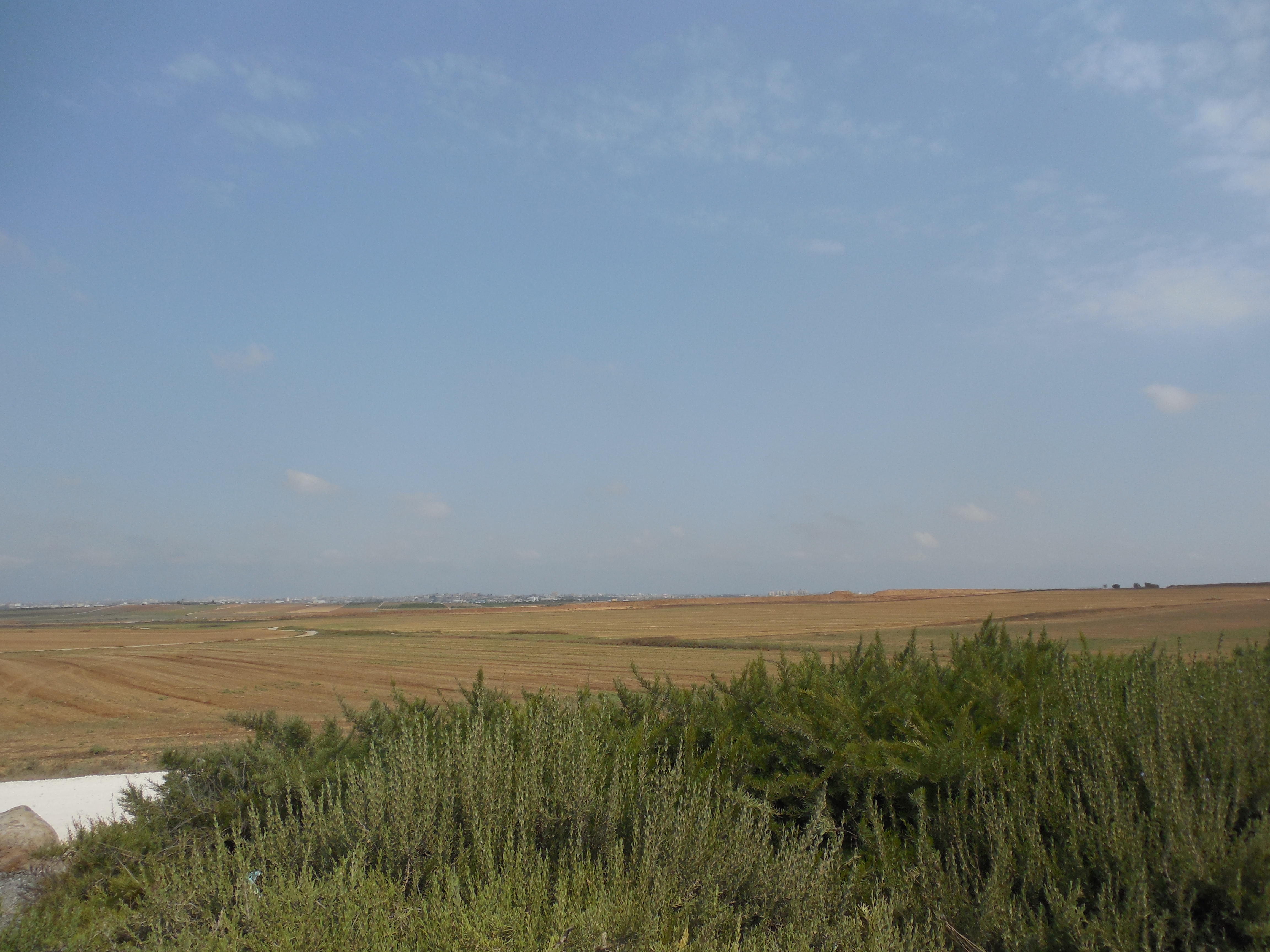
See what I mean? “That’s” Gaza in the distance. See it? Out there? The buildings on the horizon are in Gaza City.
I took this picture somewhere “along the border.” I was in Israel at the time, just west of a famous Israeli military memorial that is right on the 1950 Armistice Line. Google Maps indicates that the Memorial is about 200 feet from the 1950 Armistice Line. So wouldn’t that imply that Gaza itself was 200 feet away? Of course. But do you see anything 200 feet in the distance that looks like a border demarcation? No. There isn’t one. I looked. Looking was the whole point of going.
OK, so here we are, driving down the road “toward” Gaza. Actually, going by the map, we’re in Gaza. But in political reality, we’re not in Gaza: we’re in Israel, several miles west of Mefalsim, and several hundred yards west of the Memorial Monument. Note the tower in the far distance, on the right. It’s a lot more than 200 feet away, isn’t it? Well.
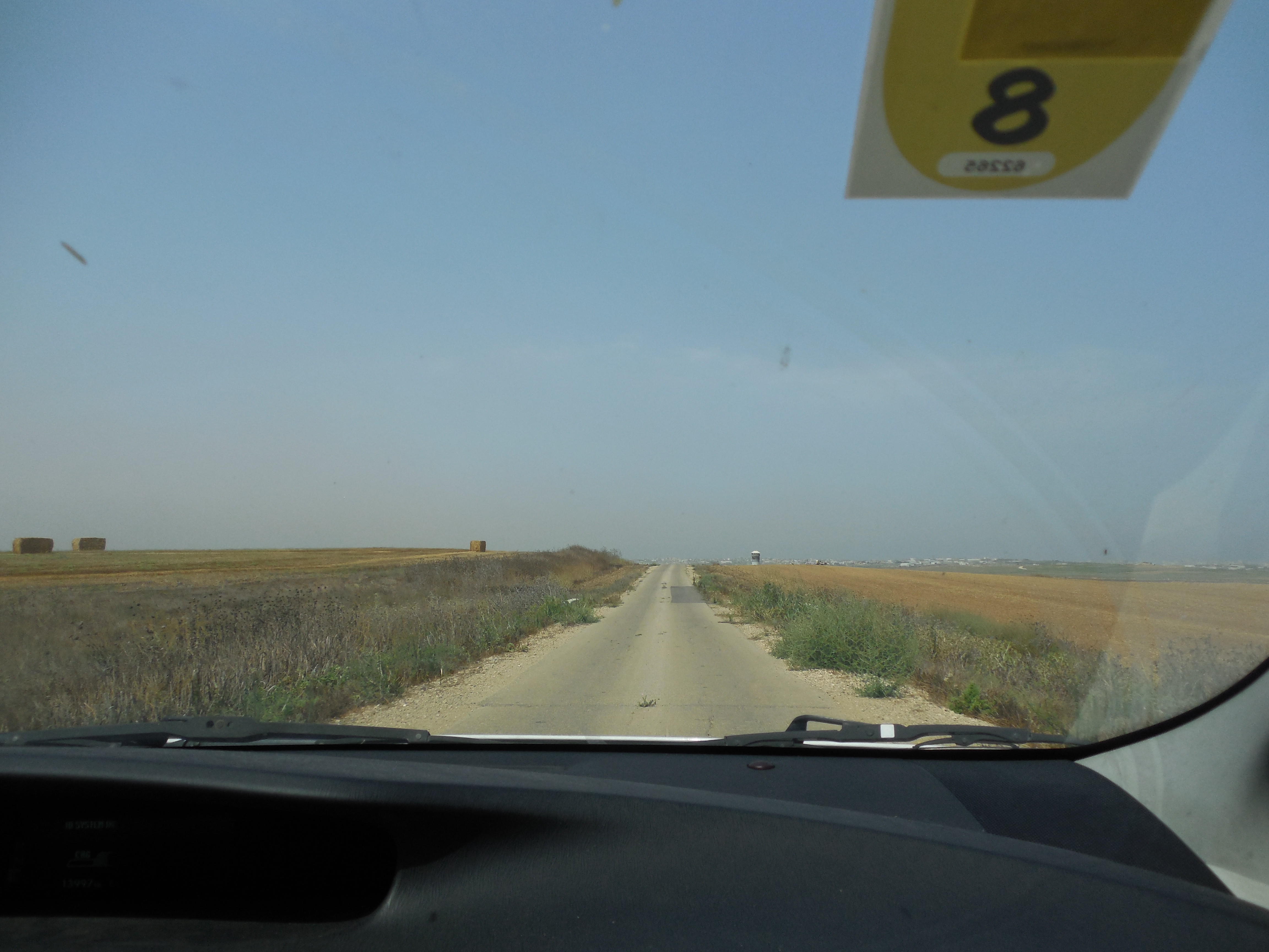
So we kept driving past the tower. Aren’t we about a mile into Gaza at this point? Yes. But Gaza is occupied territory. So for all intents and purposes, we’re still in Israel. Forget the map. Maps are geography. This is politics. Politics overrides geography.
My guide laughed at this point. “It’s a good day,” he said. “No one’s stopping us. I didn’t get this far last time.” “Are we even allowed to be here?” I asked. “Well,” he responded. “No one’s stopped us.” I didn’t say anything.***
Anyway, this brings me to rule 2:
2. It’s a mistake to infer that physical boundaries erected in the proximity of a border actually demarcate the border.
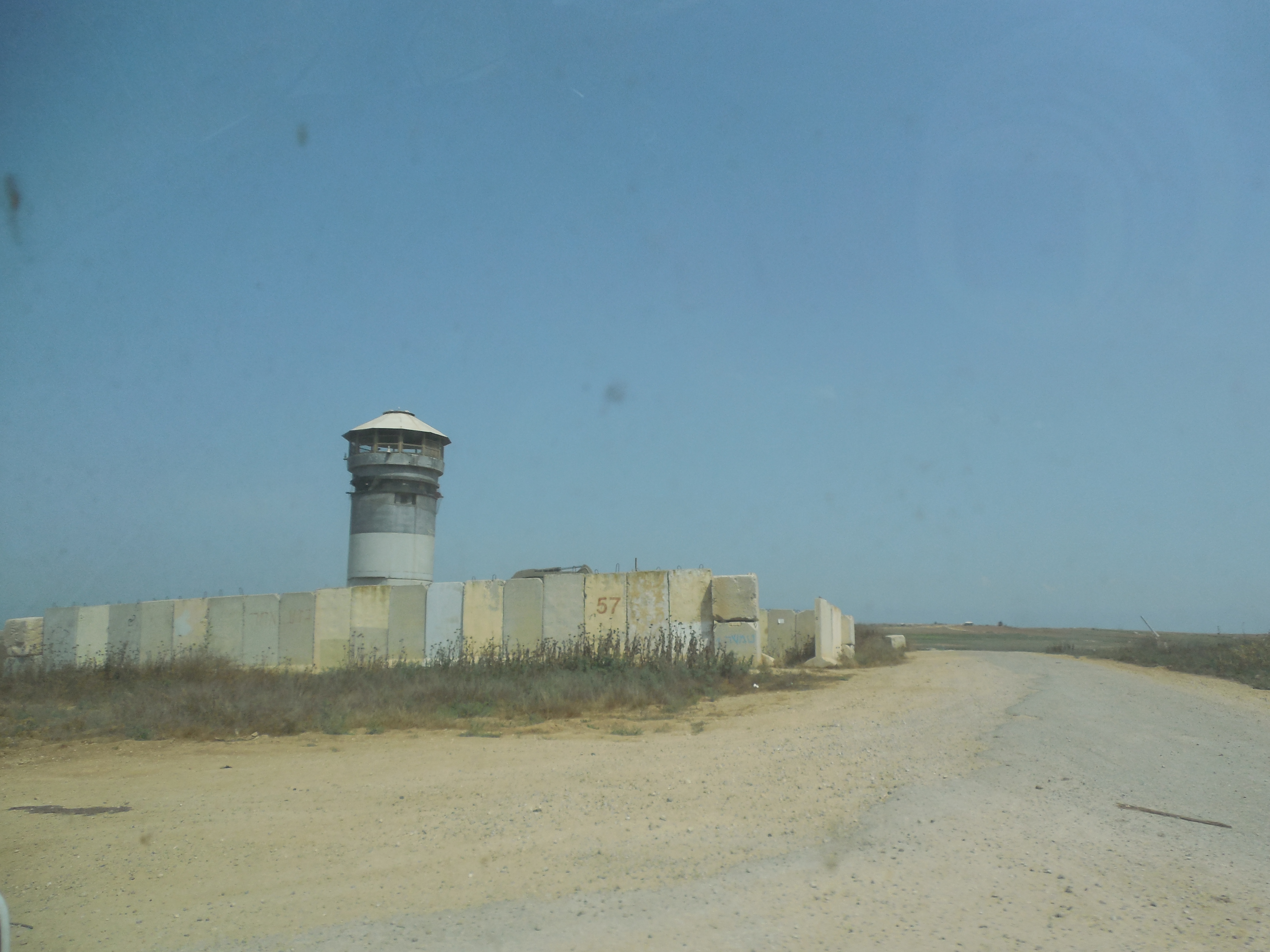
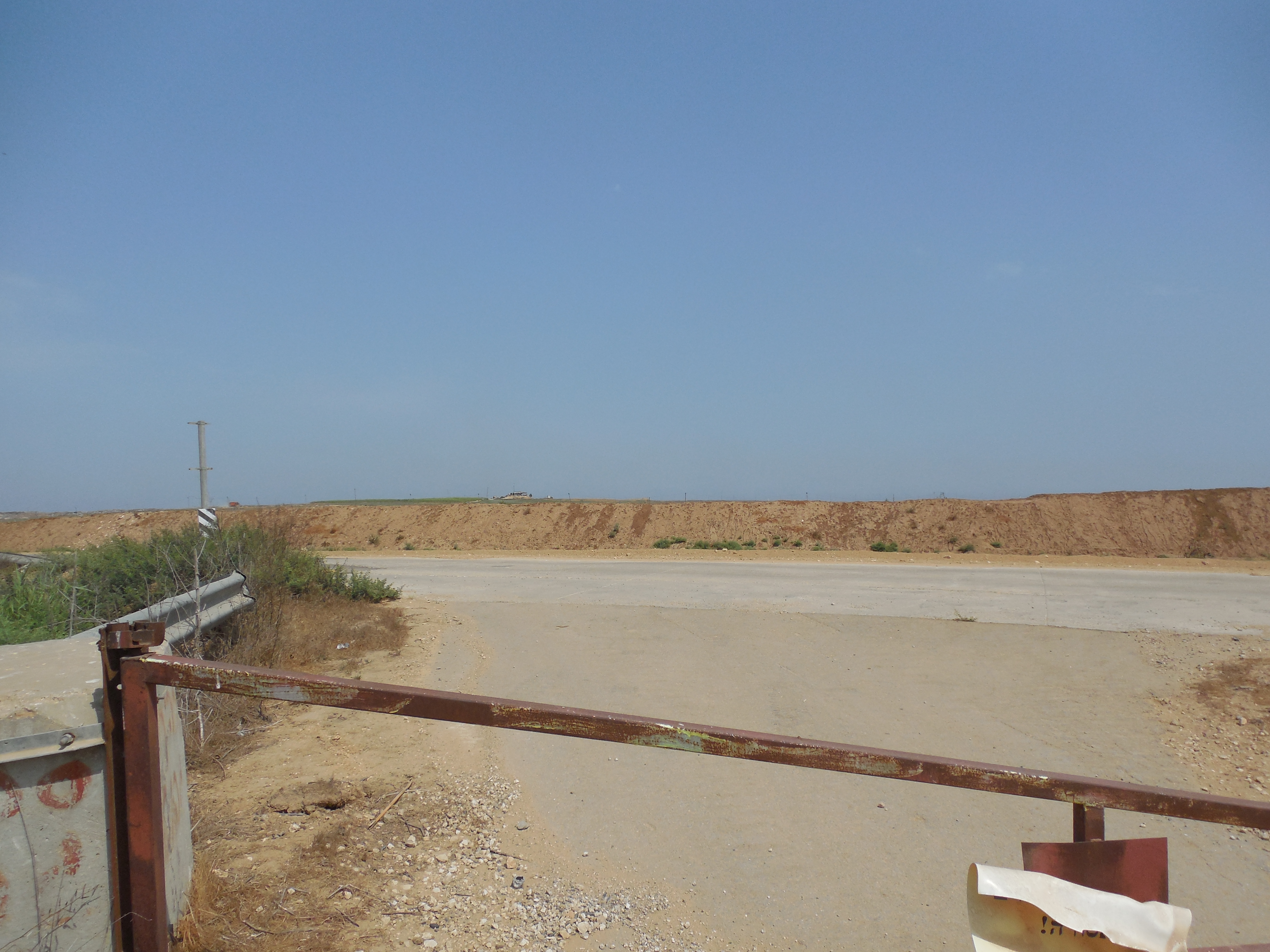
Like here. This barrier doesn’t demarcate “the boundary of Israel and Gaza.” It demarcates the “place where the Israeli-occupied road inside Gaza stops for curiosity seekers like you, and where, if you were to keep going, you would get in serious trouble.” In other words, it’s not the border, but it’s to be treated as if it was the border.
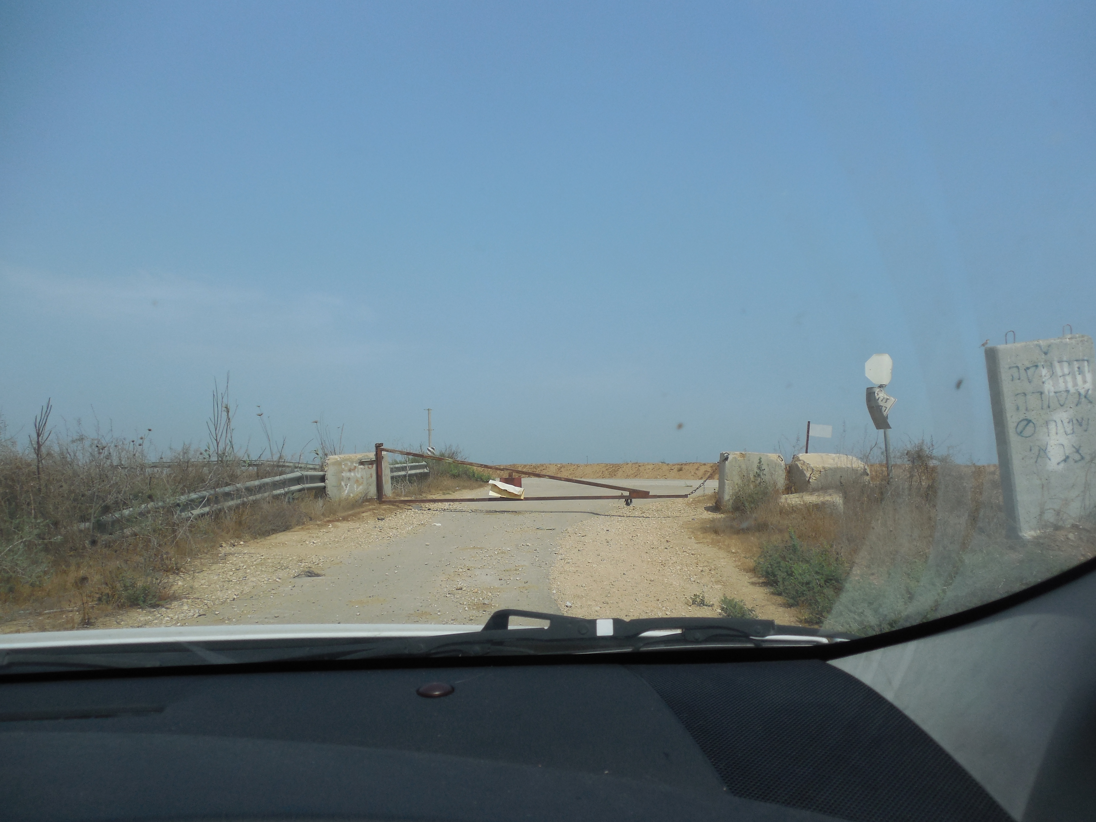
So which thing here denotes the real boundary? The iron barrier? The road? Or the dirt mound?
Answer(s): all three things are inside Gaza. All three are under Israeli military control. That said, the iron barrier is where a curiosity seeker must stop. The road is to be used only by authorized vehicles. The dirt mound marks the place after which you get shot on sight. But I’m sure you knew that, having read all about it in The New York Times and heard about it in such detail on NPR.
I decided to get out of the car to take this shot. “Yes, but please don’t go past the bar,” my guide said. I didn’t. He sat in the car. It was hot out.
Incidentally, note that I am not saying in this post that the Gaza demonstrators were or were not in Gaza (defining Gaza by the 1950 Armistice Line), whether when they were demonstrating, or when they were shot. I am simply insisting that if you want to know what really happened, you have to pay close attention to certain details about the nature of “the border,” details you would not learn simply by reading mainstream coverage.
I deeply regret the fact that I won’t be traveling to Israel/Palestine this summer. I’d have preferred to witness what was happening there with my own eyes (as I have for the past few summers) than rely for my news on witnesses like Isabel Kershner and Daniel Estrin. It’s been obvious to me for years that tensions in the area have been escalating, and that sooner or later, they would explode. It wouldn’t surprise me if this was the year they did explode. Prediction: look for gradual escalation up to Ramadan (which ends June 14), and serious intensification soon after. I take no satisfaction in that prediction, just a grim sense of resignation. I’d love to see it falsified, but don’t think it will be.
*More fully, Locke defines “political power” as “a right of making laws with penalties of death, and consequently all less penalties, for the regulating and preserving of property, and of employing the force of the community, in the execution of such laws, and in defence of the commonwealth from foreign injury, and all this only for the public good.”
My point is that Israel’s control over Gaza follows Israeli (military) law, which imposes death and lesser penalties for infraction. I don’t mean that Israeli military control over Gaza fully or perfectly exemplifies Locke’s definition. For one thing, one could reasonably dispute whether military law really amounts to law (rather than edict). And the “law” in question (if one wants to call it that) employs the force of one community at the expense of another, defining the “public good” accordingly, and treating that “other” community as “foreign” even while standing on land that belongs to them.
**I don’t mean that it has political authority over every square inch of Gaza. I mean: it retains political power over select parts of Gaza, decided at its discretion. It’s worth remembering that political power can be exercised over both areas and spaces with volume–underground, in the air, and over (and under) water. “Gaza” has both area and volume, and different entities exercise power over different dimensions of the sum total of that space.
***Deleted a pointless joke here.

Pingback: Nightcap | Notes On Liberty
Pingback: Talk Back to a Terrorist | Khawaja's Phil 250 Blog
Extremely informative (ht: John Turnbull):
https://forward.com/opinion/399738/american-jews-have-abandoned-gaza-and-the-truth/
LikeLike
very good article
LikeLike
Pingback: “Tears of Gaza” | Policy of Truth
Pingback: Israel’s Willing Executioners | Policy of Truth