Readers had trouble seeing what I was referring to in my last post, Invisible Land. Here are some snips.
Here is Longman’s shot. I’ve circled where the wall is located. His shot was taken in the evening on a somewhat cloudy day, so the circled location is relatively dark, rendering the wall hard to see in a photo. It’s not hard to see by the naked eye.
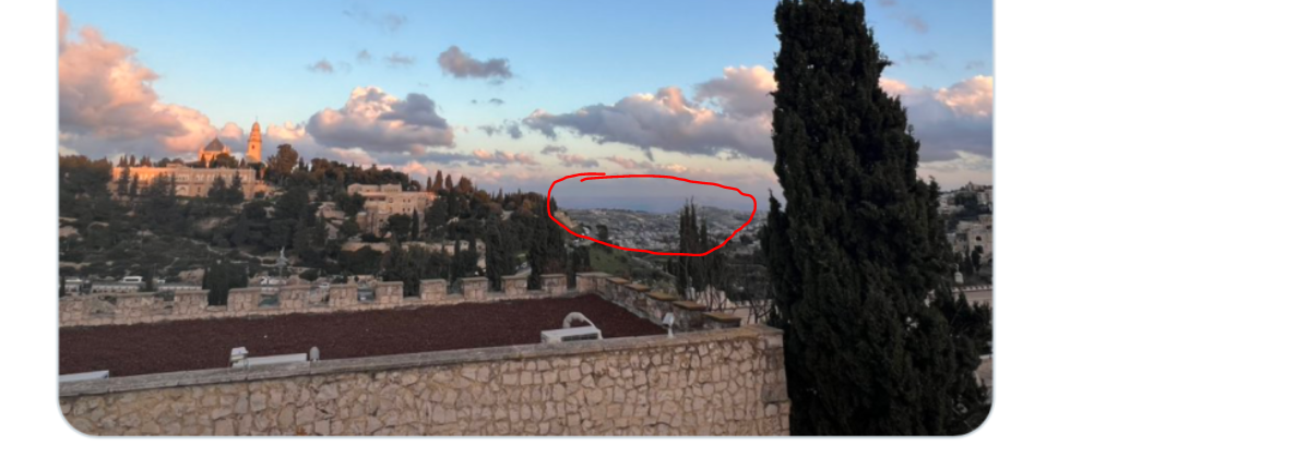
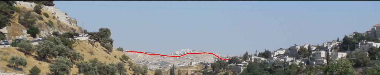
Now here is my shot, taken 1,000 yards or meters ahead of where Longman took his, but on a bright, cloudless day in the mid-afternoon. If you walk straight ahead down the hill that Longman is on, this is what you see. I’ve made this the header photo on the blog. You should be able to see the wall on the header photo where the red line is placed below.
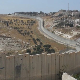
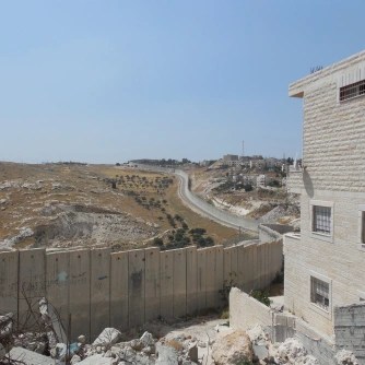


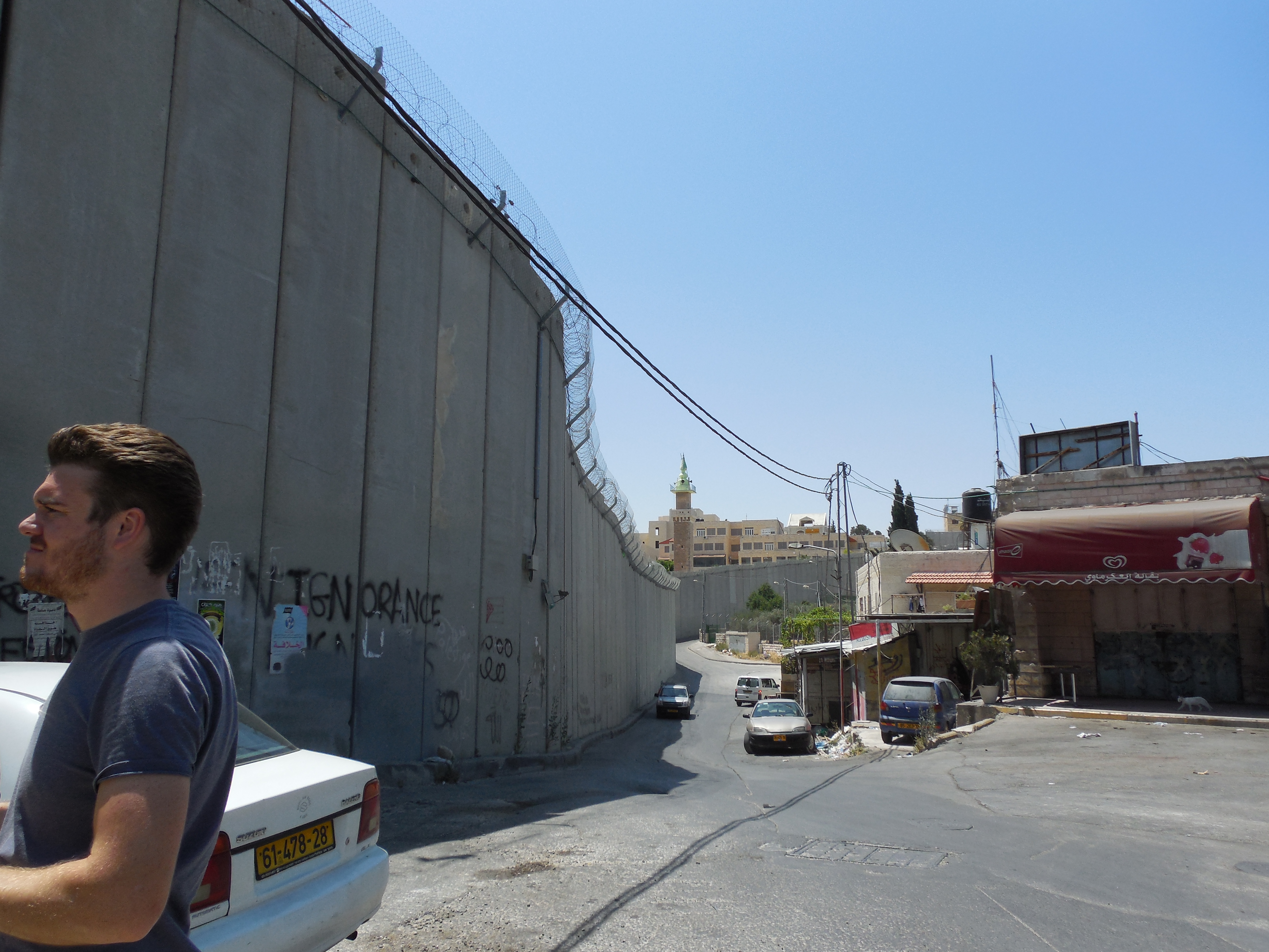
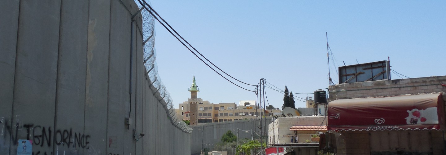
The first six shots after the first wide angle shot are the exact segment of the wall pictured in the blog header photo, but right at the wall itself. The first four look west, back toward Jerusalem from the West Bank; the fifth and sixth look east from Jerusalem toward the West Bank.
The first four shots in the gallery are the wall from Abu Dis, i.e., the Palestinian side, looking toward Jerusalem (facing west). You can see why the wall is in segments difficult to see from Jerusalem; in the first two shots, it dips into a valley and is hidden by a rocky escarpment and olive grove.
The third and fourth shots are close ups, again, from the Abu Dis (Palestinian) side, facing west. In the fourth one, obviously, I’m standing right next to the wall, and looking up.
The fifth and sixth shots are the same segments of the wall from Ras al Amud, a Palestinian neighborhood in East Jerusalem abutting Abu Dis. The “two neighborhoods” are really one, divided by the wall. These shots face east.
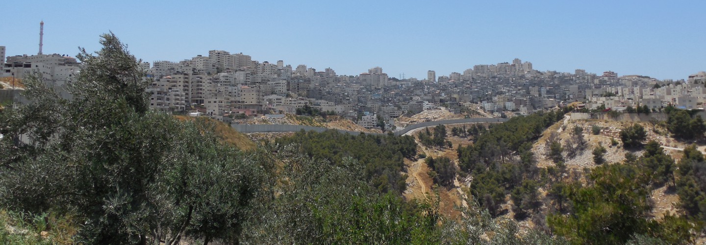
The very last, wide angle shot is a different place altogether, north of the part of the wall being discussed above. It is Shua’fat Refugee Camp seen from a vantage within the camp itself (since the wall curves in a kind of horseshoe shape). At this point, the “refugee camp” is a built-up (but lawless) city in the functional approximation of a Lockean State of Nature.
Though (mostly) within Jerusalem’s municipal boundaries, and “administered” by the UN, it has no formal government, rule of law, or system of law enforcement. It bears the name “Shua’fat Refugee Camp” to distinguish it from the neighborhood of Shua’fat within the municipal boundaries of Jerusalem itself, and governed by Israel. The wall here effectively serves to ghettoize the refugee camp, marking it off even from uninhabited spaces that Israel claims for itself (e.g., the uninhabited wooded space in the foreground of the shot), so as to prevent the further development or spread of the refugee camp. Naturally, that intensifies that population density of the camp itself.
In writing this post, it occurs to me that I have several dozen photos of the wall, especially around Abu Dis and Bethlehem, taken from several vantage points, including some rather odd ones (e.g., inside Israeli settlements). Many of these photos appear without explanation in the photo carousel in the header of the blog. It might be worthwhile trying to explain them in a coherent way at some point.

“Here is Longman’s shot. I’ve circled where the wall is located.”
Could you draw a line as to where precisely the wall is located in that circle?
LikeLike
Is this it?
LikeLike
I put the screenshot in a special post. Can you see it in my photo in the header?
LikeLike
Yes. Thanks!
LikeLike
The line you’ve marked is salient, however. It’s not the wall itself, but the point at which East Jerusalem proper ends. There’s an open space precisely where you’ve drawn your line, and then a few hundred yards to the wall.
LikeLike